DEP unveils tool to determine subsidence risk
Learning whether an area home sits on an old coal mine used to mean phoning to make an appointment and visiting the state Department of Environmental Protection office in McMurray to pore over maps with a technician.
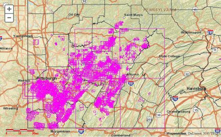
Now, a property owner, potential buyer or other stakeholder can check the subsidence potential of 15,000 properties online and decide whether to purchase mine subsidence insurance.
Gov. Tom Corbett announced the launch of the Pennsylvania Mine Map Atlas, which allows users to look at online underground mine maps and print them.
Through the atlas, one can measure the distance from a mine to a specific structure. This function will help identify homes and other structures at risk for mine subsidence.
If a home is atop an undermined area, or one is nearby, DEP recommends that a homeowner purchase mine subsidence insurance.
In a news release Thursday, DEP trumpeted the new service but noted that the department must still scan 40,000 maps.
The mine map viewer has been under development for more than 10 years.
“We do not have an end date,” said Amanda Witman, DEP spokeswoman. “It will definitely be several more years.”
The project, which cost $51,541, was a joint initiative of DEP’s Mine Subsidence Insurance Program and Penn State’s Pennsylvania Spatial Data Access Program.
It was funded by Surface Mining Conservation and Reclamation’s general operations budget. The money comes from fines, penalties, permits and licenses paid by the mining industry.
Witman recommended that those who use the online service “check in with the Mine Subsidence Insurance program through its website or call. We don’t want anyone to read a map incorrectly or have a keystroke error. You always want to be safe rather than sorry.”
She called the atlas “a great starting point to follow up with the MSI program because they can identify if coverage is necessary.”
Ground movement caused by the collapse of old, abandoned mines is typically excluded from homeowners’ insurance policies.
No one should search Donaldson’s Crossroads Shopping Center in McMurray for the DEP office, a long-time tenant. It moved years ago to California Borough, where it was the first of six offices to tackle the project.
Anyone without computer access to the underground mine atlas can call 800-922-1678.
The state created its mine subsidence insurance fund in 1961 with an appropriation of $1 million.
The policy covers only structural damage, not the loss of use or personal property.
In Washington County since 1999, the U.S. Department of Interior’s Office of Surface Mining has hired contractors to fill old underground mines with concrete beneath homes on Bremen Lane, Peters Township, the site of the Montour No. 4 mine; Pittsburgh Coal Co.’s Allison Mine in the Allison Plan, Chartiers Township; on Hodgson Street, Monongahela; and beneath the Magnolia Mine in Cecil Township, which was abandoned in 1936.
Witman said the average amount of mine subsidence loss is $50,000, but the program has paid out claims in excess of $200,000.
The average cost of mine subsidence insurance is a dollar a day after the state lowered the premiums last summer, Witman said.
Subsidence can occur when water fills mine voids and rots the timbers that once supported the roofs of underground tunnels in what is known as the room-and-pillar method of mining.
In modern longwall mining, ground collapses as huge machines churn away at the coal face.
For more information about MSI, or to check local mining conditions, go to www.pamsi.org or www.paminemaps.psu.edu.