Canonsburg deploys AI tool to assess road conditions
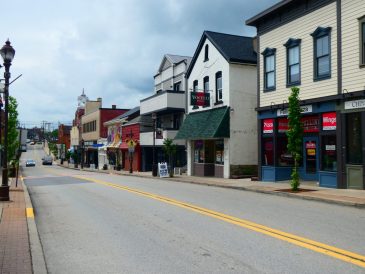
Canonsburg officials have completed a full scan of the borough’s nearly 40 miles of roadways using a new AI-powered software tool and are currently assessing the data it generated.
Borough council approved a $10,000 outlay to acquire the Vialytics Software in April in hopes that it could improve the efficiency of its public works employees and ongoing road maintenance efforts.
The software operates via a smartphone mounted to the hood of a vehicle that takes photos of the road at regular intervals, which is then fed into an AI-assisted program that assigns a numerical score based on a constellation of metrics.
The Pavement Condition Index score is a quantitative metric from the Pennsylvania Department of Transportation’s standards for road integrity.
A perfect score of 100 indicates a road is in flawless condition, while a score of one means that the road in question needs immediate intervention, according to Borough Manager Jennifer Foster, who is spearheading the assessment effort with Martin Grissieon, an intern from Washington & Jefferson College.
The program generates a color-coded map of scanned roadways and an Excel spreadsheet that contains a written version of the same data.
This data will be used to determine which sections of road are most in need of repair, which can then inform grant applications to both Washington County and the state Department of Transportation.
“It’s a really cool thing to visually see it like this,” Foster said.
Foster said having a definitive metric for road integrity helps eliminate any bias from human assessment.
“The data is so transparent, so objective, it’s not biased or based on any one person just saying ‘I think we should do this one’ because they say so,” she said.
According to Grissieon, the entire scanning process took approximately 32 hours of driving time, which was “pretty easy” overall.
The analysis component could take until late July to fully complete, he said.
The preliminary results indicate that over 25 miles of borough roads score 60 or above, with an overall average of 70, according to Foster.
An initial list of the 10 sections of road most in need of attention has already been generated from the data, with a more comprehensive list in development.
Foster said the plan is to eventually release the data from the scan on the borough’s website for public inspection once she can find a suitable host format.
Grissieon will present the preliminary recommendations from the Vialytics analysis during the next council meeting on July 13.