Expansion of new nation started with trip along Ohio River
Editor’s note: It is impossible to tell the story of the nation without telling the story of the Ohio River Valley. Long before interstate highways and railroads, it was the rivers that served as the young nation’s first true highway westward. In many ways, the journey chronicled this week represents the true beginning of America’s westward march. What started with a determined group of men leaving Massachusetts in the bitter winter of 1787-88 would culminate in the founding of Marietta, the first organized settlement in the Northwest Territory.
Following the Revolutionary War, the newly formed United States were eager to begin expanding beyond the borders of the original 13 states.
Land south of the Great Lakes and north of the Ohio River had been ceded to the United States from the British following the Treaty of Paris in 1783. The young country struggled getting the area that would eventually form Ohio, Indiana, Illinois, Michigan, Wisconsin and Minnesota organized. Squatters were moving onto the land, there were still pockets of the British, and the Native Americans that had been on the land for centuries were not thrilled about the influx of new people. The passage of the Northwest Ordinance in 1787 would set in motion the authorized development of the land.
But even before the ordinance, a group of men were planning how to develop the land once it opened.
On Jan. 25, 1786, Gen. Rufus Putnam and Benjamin Tupper started promoting the idea of forming the Ohio Company to settle land near the Muskingum River, in what today is southeastern Ohio. The information appeared in “public prints” and encouraged those interested in being shareholders in the plan to meet at the Bunch of Grapes Tavern in Boston.
The meeting on March 1 of that year at the Bunch of Grapes not only resulted in getting underwriters but also set up a convention to begin a few days later. At the convention, they set up a series of 13 articles that would help form the new settlement.
The next year or so entailed organizing the company and getting funding in place. On March 8, 1787, the associates met again, and Putnam, the Rev. Manasseh Cutler and Gen. H. Parsons were named directors. They came up with the plan to buy land from the Continental Congress. After negotiations the group ended up with 964,285 acres of what Thomas Hutchins, geographer of the United States, considered “the best part of the whole western country.”
At a November 1787 meeting, they decided on the size of house lots. At a meeting at Bracket’s Tavern, the group decided on the makeup of the first party to head to Ohio.
According to the plan, the first group would be made up of four surveyors, and 22 men to “attend” the surveyors; six boat builders, four house carpenters; one blacksmith and nine common workers for a total of 48.
On March 5, 1788, Putnam was given “full power to do and transact all matters necessary for the progress of the settlement.” At that point he was already on the road that would in April 1788 lead him to Ohio.
Before the group of 48 men of the Ohio Company could establish Marietta in 1788, they first had to get here.
The trip overland from Massachusetts started Dec. 31, 1787. The trip over the mountains was hard. They battled deep snow, at times building sleds to make their way west.
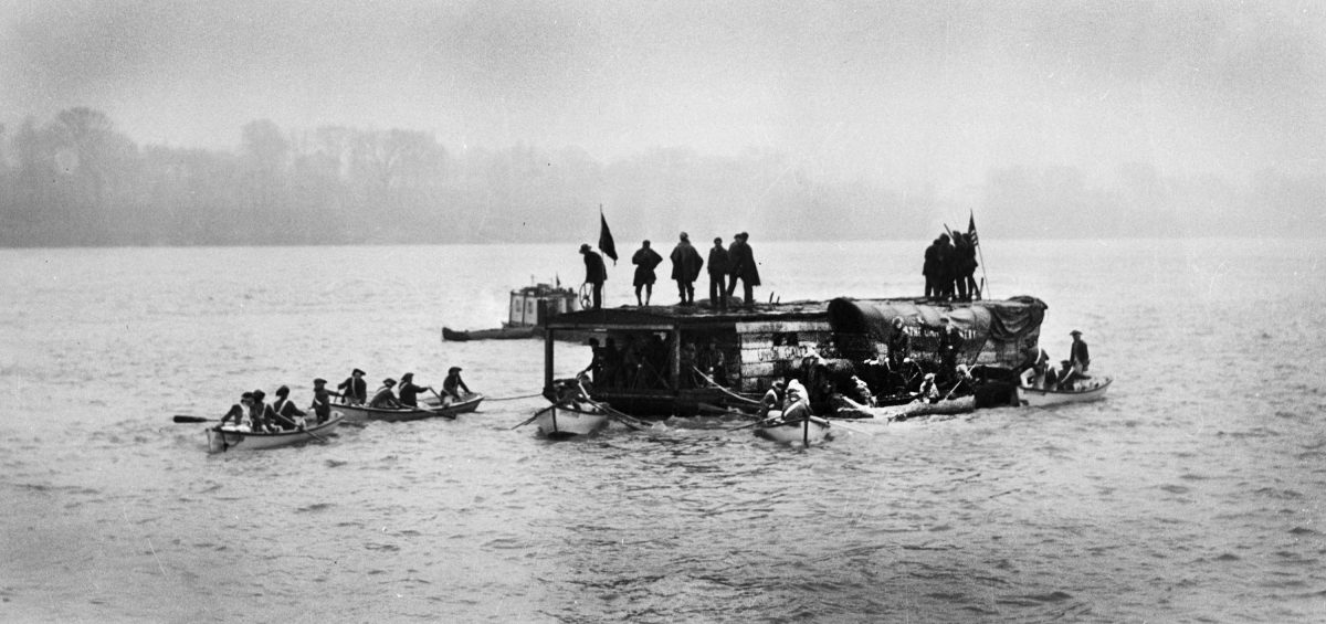
When they arrived at Sumrells Ferry on the Youghiogheny River they would have to prepare for the second part of their journey, which would take them down tributaries to where the Monongahela joins the Allegheny to form the Ohio River at Pittsburgh, and finally to Marietta, arriving 238 years ago on April 7, 1788.
Putnam kept a daily account of what the journey was like. The journals offer a detailed narrative of the struggles faced by the men getting here as well as the early steps in carving a city out of the wilderness.
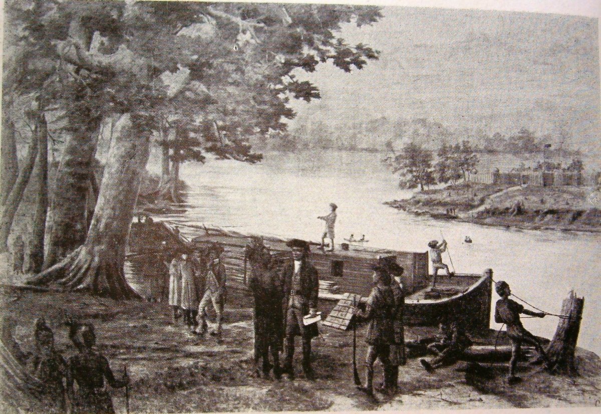
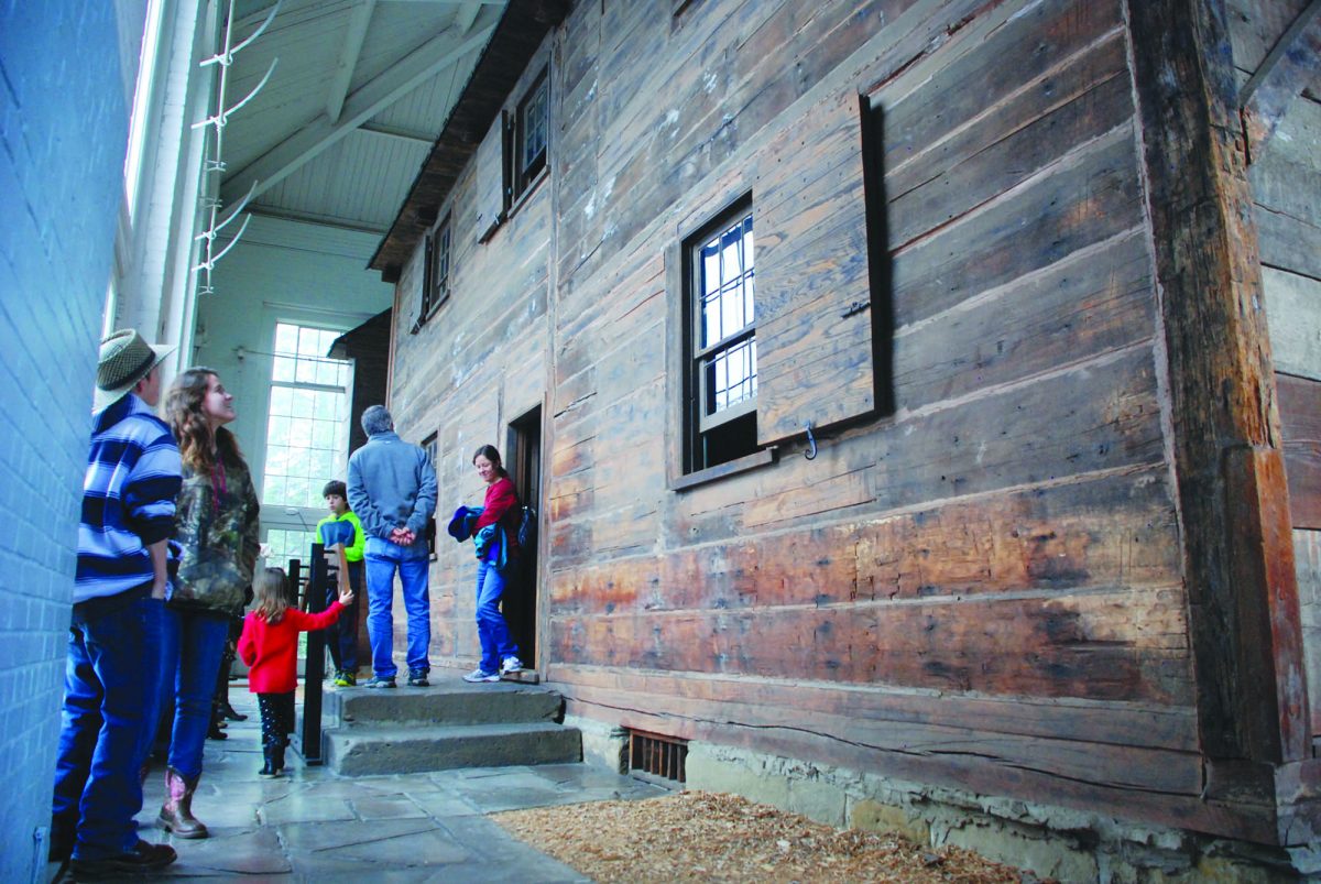
The 48 men who made the initial trip to what is now Marietta quickly got busy clearing the trees. Trees were needed to build housing, and the land would have to be prepared for crops. Fort Harmar, one of several military outposts along the Ohio River, stood along the western bank on the Muskingum River at the confluence with the Ohio. Members of the Ohio Company chose a spot about a mile upstream on the east side of the Muskingum to build Campus Martius, a fortification that would provide protection from attacks by native Americans. Today the Campus Martius Museum details the journey and contains Putnam’s house and the Ohio Land office, the oldest building in the state.
Food was plentiful at first for those setting up the new town, with deer and bison easy to find.
By the summer of 1789 it was becoming harder to find enough food to eat thanks to a clearing out of the animal by Native Americans angry over a treaty. An early frost in October ruined an already weak corn crop forcing the citizens to turn to their neighbors across the Ohio River for help. Isaac Williams, the owner of the Virginia plantation in what would later become Williamstown, W.Va., sold corn to Capt. Johnathan Devol and Isaac Barker who paddled across the river to make a deal.
The naming of the young city took even longer than the planning of it. Many in the Ohio Company also had strong connections to the Scioto Company further down river. The Scioto Company had connections to France so many favored naming the new city on the Muskingum “Marietta” to honor Marie Antoinette, queen of France, to gain support from the monarch.
A lot of other names had been suggested prior to Marietta being the officially chosen name on July 2, 1788. Castrapolis, Adelphia, Muskingum, V de Mariana, Marianne and Mariana were all considered.
Marietta was the first city created in the Northwest Territory. None of the cities settled before Marietta were done so under United States law because the land was not officially part of the nation. Not until the Ordinance of 1787 was the establishment of the Northwest Territory possible. The ordinance gave a pathway for lands to be settled and eventually to become states. There were plenty of people throughout the area, however. In fact, those that founded Marietta passed by many of them on their way down river.
People were trying to settle Martins Ferry as early as 1779. Nearby Wheeling, Va., had been a town since 1769 when Ebenezer Zane decided it would be a good place for a community by marking trees with an axe. Wheeling, of course, was already part of Virginia, and Virginia had been a state from the start. The 48 men aboard the Adventure Galley would have passed both settlements on their way to the “frontier” that would become Marietta less than 100 miles south.
In other states of the Northwest Territory, people were setting up towns long before 1788.
Vincennes, founded in 1732, is Indiana’s oldest city – it was settled by the French and had a thriving fur trade. Sault Ste. Marie was settled as early as 1668, making it the oldest city in Michigan. There are several communities in Illinois that are older than Marietta. The largest, Peoria, was founded in 1691 by French explorer Henri de Tonti.
Further north in Wisconsin, Green Bay was settled in 1754 as Baie Verte (French for “The Green Bay.”)
Although Marietta got a jump start on other cities in Ohio, it never grew to be a large town. During the early growth period, thousands passed the city on their way further south; flatboats filled the river on their way to Kentucky and Cincinnati, which quickly grew larger than Marietta.
Today the efforts of the Ohio Company are celebrated. Tourism is an important part of the region’s economy. The Sternwheeler Valley Gem provides river tours on the Ohio and Muskingum rivers, and Campus Martius Museum tells the story of the establishment of the Northwest Territory and features the home of Rufus Putnam. A new Ohio River Museum is under construction where the 174-foot sternwheeler W. P. Snyder Jr. helps to explain the role the rivers played in the history of the area.
Efforts are also under way to restore the 1938 National Memorial to the “Start Westward of the United States.” The sandstone monument is the centerpiece of Muskingum Park. It was carved by Gutzon Borglum and dedicated by President Franklin Roosevelt to mark the 150th anniversary of the Northwest Territory.
With westward expansion at hand for the new nation, it’s also important to delve into how the new federal government worked to tie together the existing states and the new frontier, which will come next week. One of the most important pieces of that plan was the creation of the National Road. Approved by Congress in 1806 with work getting underway in 1811, the road would eventually stretch from Cumberland, Md., to Vandalia, Illinois.