First significant snow of season expected in region
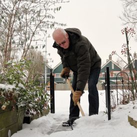
Snow shovels will be in use Tuesday as the first significant snowfall of the season is expected to hit the region.
A winter weather advisory has been issued for Southwestern Pennsylvania, with the first significant snowfall of the season expected to hit the area Tuesday morning – just in time for morning commutes.
The National Weather Service in Pittsburgh said the winter storm advisory spans from Arkansas to New York, and includes Pittsburgh’s entire forecast area, including Washington, Greene, and Fayette counties.
Snowfall is expected to start around 3 a.m., with heaviest precipitation likely between 4 and 8 a.m., according to Liana Lupo, a NWS PIttsburgh meteorologist.
“During the heaviest rates of snow, you can expect at least a half an inch an hour between 4 or 5 a.m. and 8 a.m., very much in time for the morning commute, which is what’s making this worse,” said Lupo. “Those rates will reduce as the system moves out, roughly by noon or 1 p.m.”
Most of the area is looking at an accumulation of 3 to 5 inches, with the exception of the Mon Valley, where a mixture of rain and snow may lower totals to 1 to 2 inches.
Temperatures will be below normal this week, with highs in the mid-30s, according to the NWS.
Lupo said the snow is going to be wet and heavy, which will impact visibility and contribute to slippery road conditions.
Lupo said the snowfall likely will impact motorists trying to get to work or to appointments Tuesday morning.
“Be very careful on the roads if you have to be out. If you don’t have to go out, don’t go out. If you have plans in the morning, try to delay them until later in the day if it’s possible,” she said.
School delays are possible as well.
Most of the snowfall should end by early afternoon.
The Pennsylvania Department of Transportation District 12 said crews will be treating roadways.
The department has plenty of salt and anti-skid available, and crews will be pre-treating major routes throughout the four-county region, which includes Fayette, Greene, Washington, and Westmoreland counties.
Anti-icing involves wetting the highway with salt brine before a storm’s arrival. The solution lowers the freezing point of water and slows or prevents ice from forming a bond with the pavement during the early stages of a storm.
Roadways will not be free of snow while precipitation is falling, PennDOT said. With freezing temperatures, roads that look wet may actually be icy, so extra caution is needed when approaching bridges and highway ramps where ice can form without warning.
PennDOT issued winter driving advice for motorists who need to be on the roads:
Slow down and increase following distance;
Avoid sudden stops and starts;
Use extra caution on bridges and ramps, where ice often forms without warning;
Keep your gas tank at least half full;
Remove ice and snow from windows, mirrors, and all vehicle lights before you drive and as often as needed;
Use your low beams in particularly bad weather, especially in cases of heavy or blowing snow.