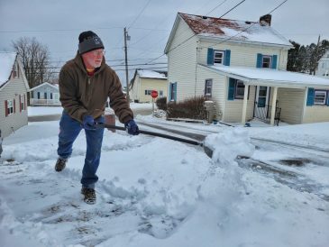
Trend toward warmer, less snowy winters

There have been memorable winters in Southwestern Pennsylvania, said Jack Hughes.
“The Great Appalachian Snowstorm” of 1950, which dumped 27.4 inches of snow on the region over a three-day period on Thanksgiving weekend, en route to a record year of 82 inches.
And the blizzard of 1993, which gave Uniontown its single-day snowfall record of 23.6 inches — in March, no less.
Or the “unbelievable cold” of 1978, when the regular January thaw never came and there was at least 1 inch of snow on the ground between Jan. 8 and March 12.
Also the early snow of Oct. 4, 1974, right after Hughes moved to the mountains by Chalk Hill, when it snowed off and on all day, even down in Uniontown.
Though a big storm or snowy winter can still come in any year, Southwestern Pennsylvania has seen a gentle but noticeable trend towards lower snowfalls.
Hughes manned a weather station on Chalk Hill for 40 years.
Some trends stuck out: earlier springs; hotter, more intense summers; warmer falls, with later-developing fall colors.
And also, “softer” winters — milder than normal, and less snowfall than normal.
“Does that mean this year we couldn’t have a 50-inch winter?” he said. “No, but over the long pool, the trend that we’re seeing is towards the softer winters.”
Chris Leonardi, a meteorologist with the National Weather Service in Pittsburgh, said snow totals have trended down slightly, though it’s not a simple downward path.
Over the past 30 years, Waynesburg’s highest total was 70.7 inches, which came in 2010. But compared to the 15 years before it, the past 15 years have tended towards lower peaks, Leonardi said — the next-highest totals were 45 inches in 2014 and 35.9 inches in 2021.
The same trend happened in Connellsville, which hasn’t been higher than 47.1 inches since 2014.
“I think you’re going to see that at most sites in the region, because temperatures have been warmer overall in most cases, and that’s going to cut down your totals as far as snow,” he said.
In Waynesburg, average 24-hour temperatures have been at 51 degrees or higher for nine straight winters, Leonardi said.
Waynesburg and Connellsville both came in below average last winter, with 15.1 and 19.7 inches, respectively.
Due to a decline in cooperative observers over the years, the NWS has not had reliable snowfall data from Washington since 2014, Leonardi said.
Southwestern Pennsylvania averages about 40 inches — maybe an inch or two more for Pittsburgh, maybe an inch or two less for Uniontown or Greene County, Hughes said. That can change drastically with elevation, Hughes said. Up in the Allegheny Mountains, the average is around 88 inches, and 100 at the summit. At places like the Seven Springs Resort, it can be closer to 125 inches.
A warming climate can actually mean more snow in lake regions and higher elevations, Hughes said. Warmer temperatures mean Lake Erie doesn’t freeze over. That allows for lake-effect snow, as colder air coming from Canada picks up moisture, producing snow as it hits the hills. By the time it gets to the Allegheny Mountains, the upward travel of the air can make the effect even more pronounced, Hughes said.
Overall for the region, this year’s snowfall is expected to be, if not 50 inches, at least closer to average.
The seasonal weather outlook from the National Weather Service leans toward warmer-than-average temperatures for the region from December to February.
For precipitation, the model shows an equal chance of drier or wetter weather during those months. Of course, if temperatures are higher, that’s more likely to manifest as rain.

